Top 5 Reasons You Should Use A Drone For Your Architectural Project Photography
It's hard to imagine that drones have really only been a photography tool over the last decade or so and, in my opinion, they really didn't produce the quality of images needed for architectural photography until the last few years. Before drones, photographers were using long poles and helicopters to get higher elevations. I personally owned a 25' light stand that I would mount my camera onto and carefully hoist it into the air. I would need to wait for it to stop wobbling before I could capture my photo. Now I can throw my Mavic 3 into the air in just a couple of minutes and capture perspectives that would have been impossible just a few years ago.
Despite them being a very cool and useful tool, I try to be very intentional when using a drone as it serves a very specific purpose - to capture an "impossible" yet compositionally pleasing perspective that makes your project shine.
Here are my Top 5 reasons a drone should be used to help capture your project.
1. Difficult to reach perspectives
This goes without saying. Many homes are built on the side of a hill or in other challenging terrains where traditional tripods and camera positions just can't get the perspective that is needed. The drone will allow us to get to a perspective that truly shows off the uniqueness of the design and parts of your project that people normally won't be able to see due to these limitations.
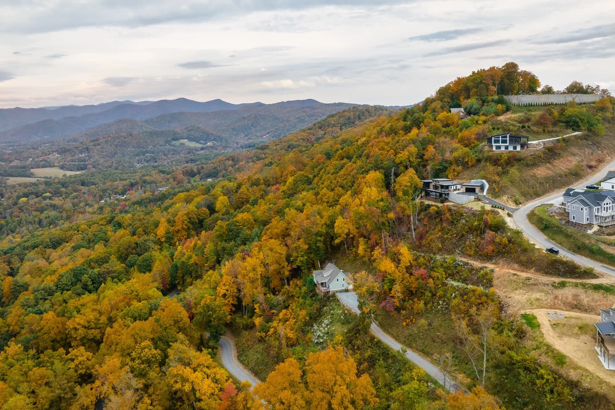
Aerial view of a modern home by Red Tree Builders in Asheville, NC in the fall, a perspective that simply isn't possible from the ground.

The drone positioned over the ravine behind this home to capture the rear elevation and tiered deck structure in this real estate photo.
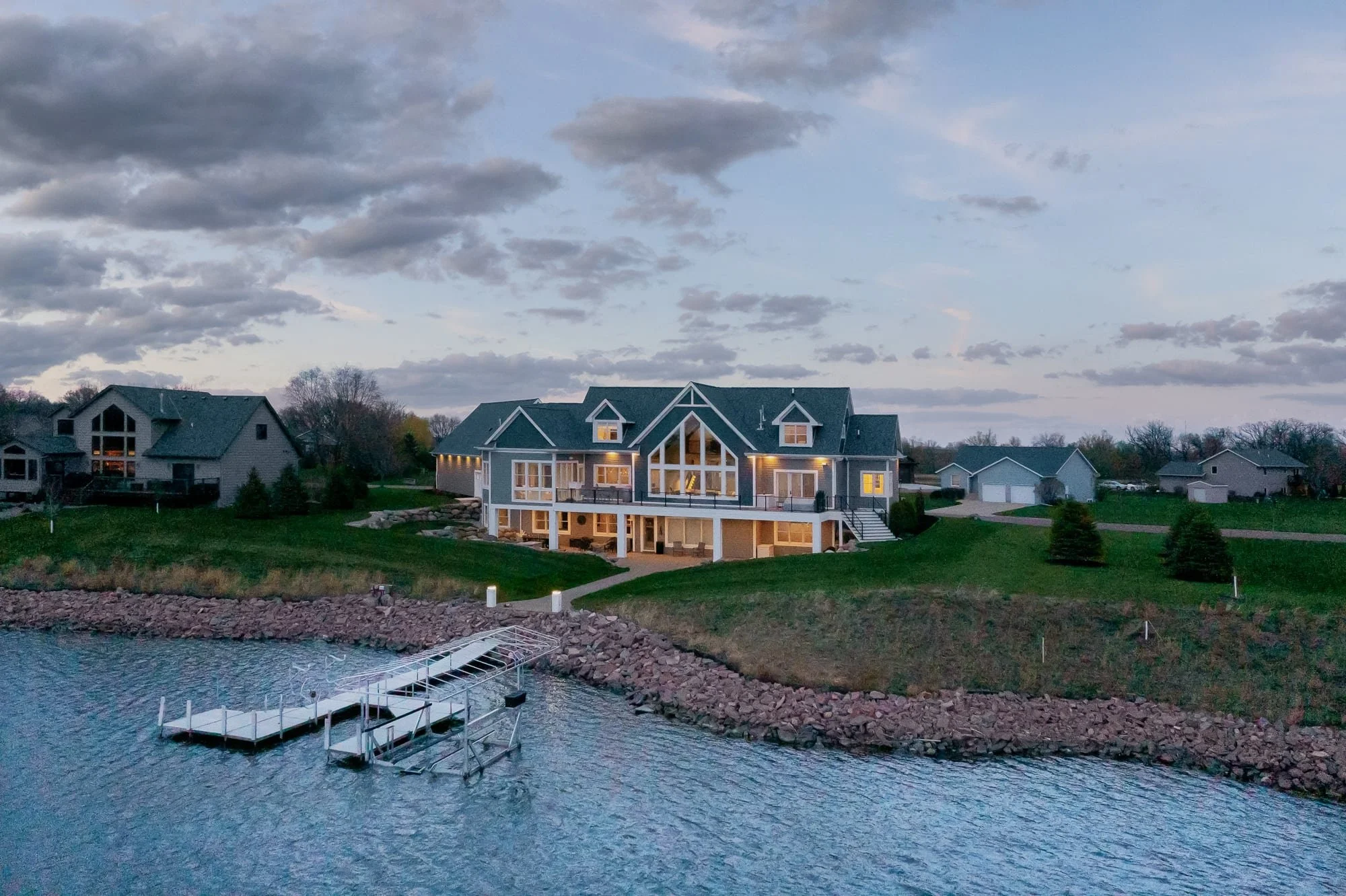
A lakefront home in Minnesota at dusk, the only way to show the relationship between the house, the lawn, and the water.
2. Capturing Details and Footprint Photos
Whether you want to show the details of a roof, the shape of a lot, or the footprint of a structure, shooting from directly above can be a unique perspective that only a drone can capture.

A commercial rooftop solar array in Minneapolis, MN, shot straight down to show the scale and organization of the installation.
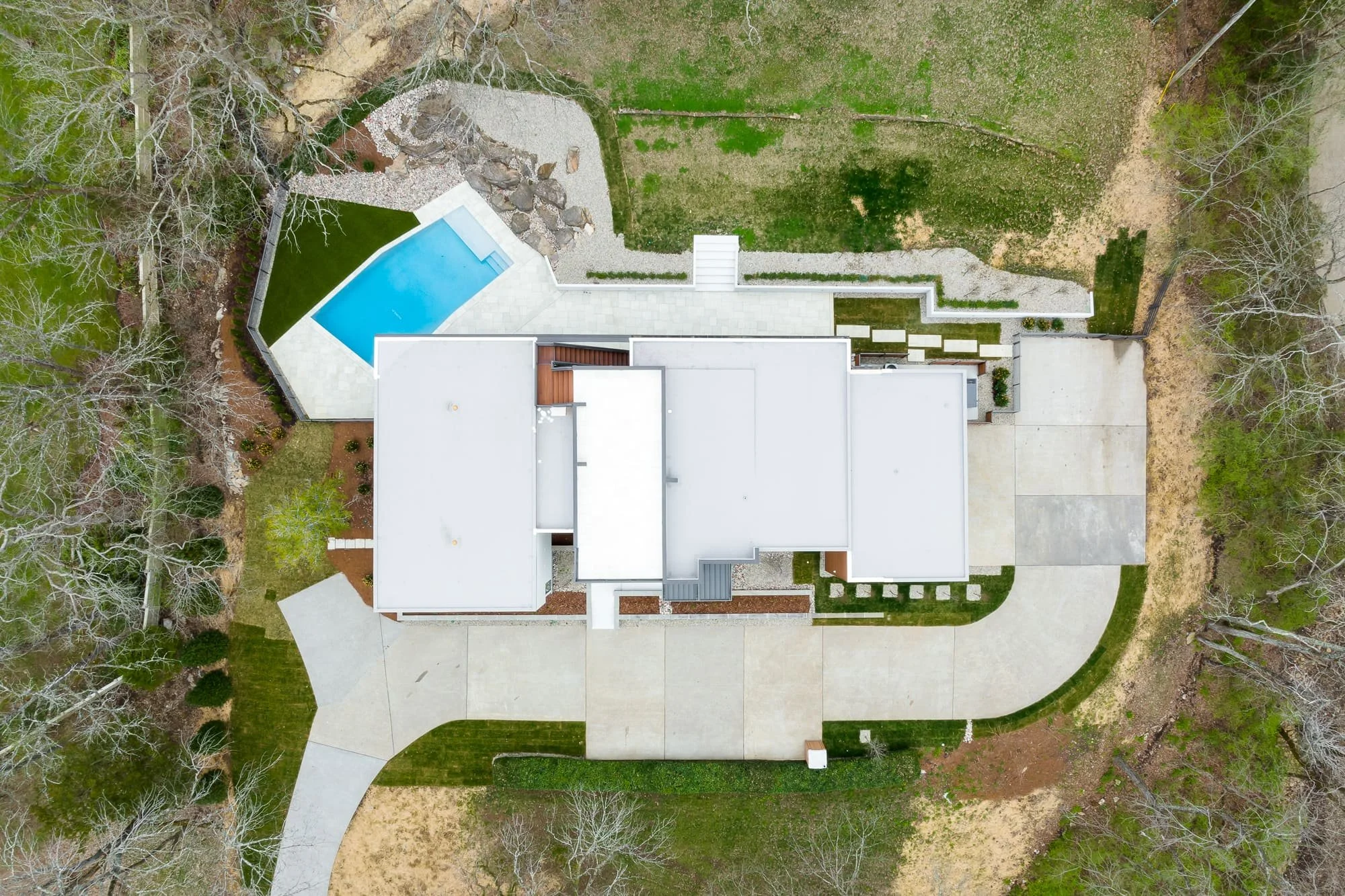
A modern residential home in Nashville, TN photographed from directly above to show the full footprint and pool layout.
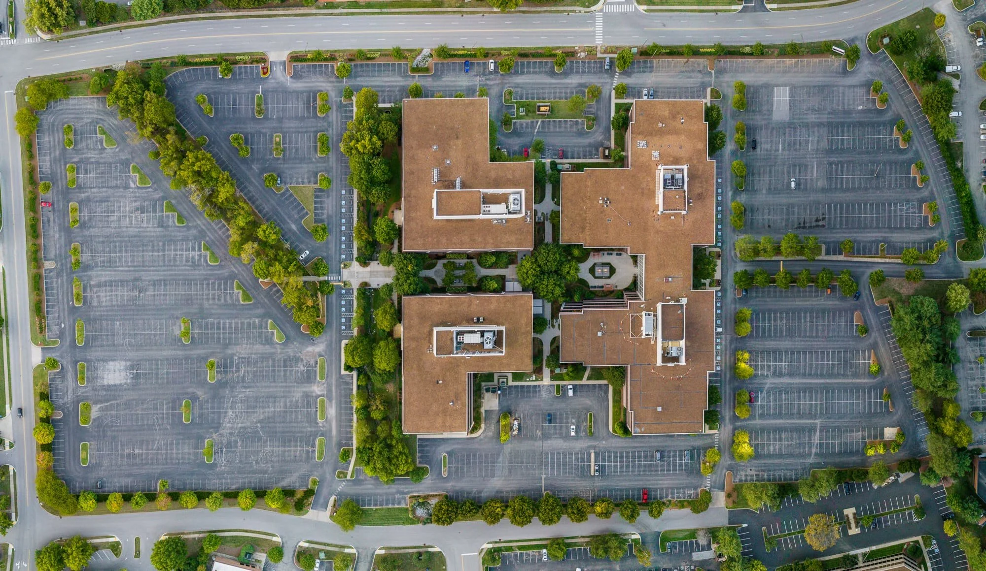
The full property footprint of a commercial campus in Franklin, TN, showing how the building sits within its site.
3. Showing Your Projects Surroundings
Sometimes the surroundings are just as important as the project itself, and in many cases the only way to capture the true scope of the work is to view it from the air. This is especially true in larger downtown areas where the only way to get certain perspectives without a drone is by gaining access to rooftops or balconies of neighboring buildings.
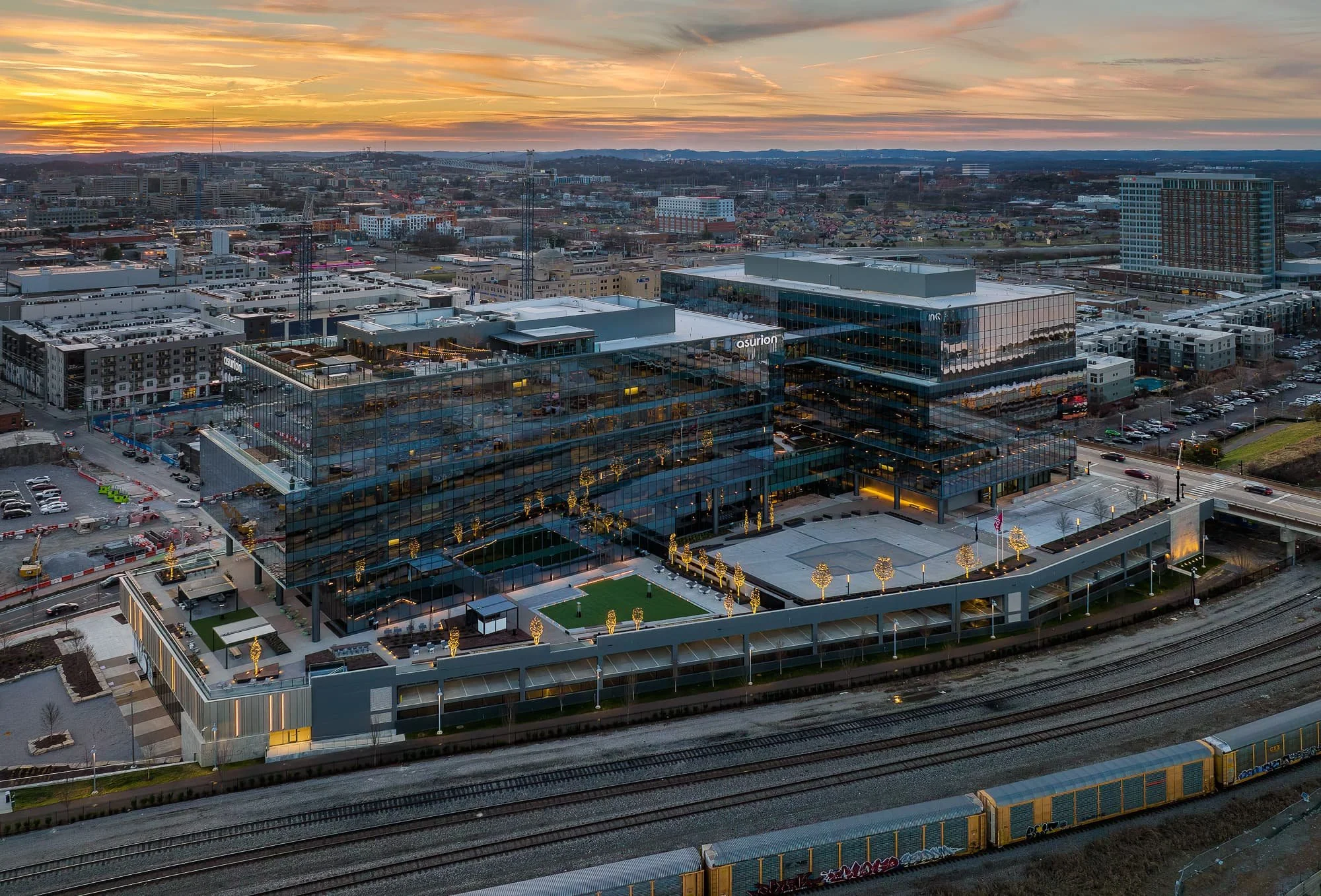
Asurion HQ in downtown Nashville at sunset, the only way to show the full campus and its relationship to the city.

The Countrypolitan Hotel in downtown Nashville, with the surrounding city providing the context the ground-level shots couldn't.
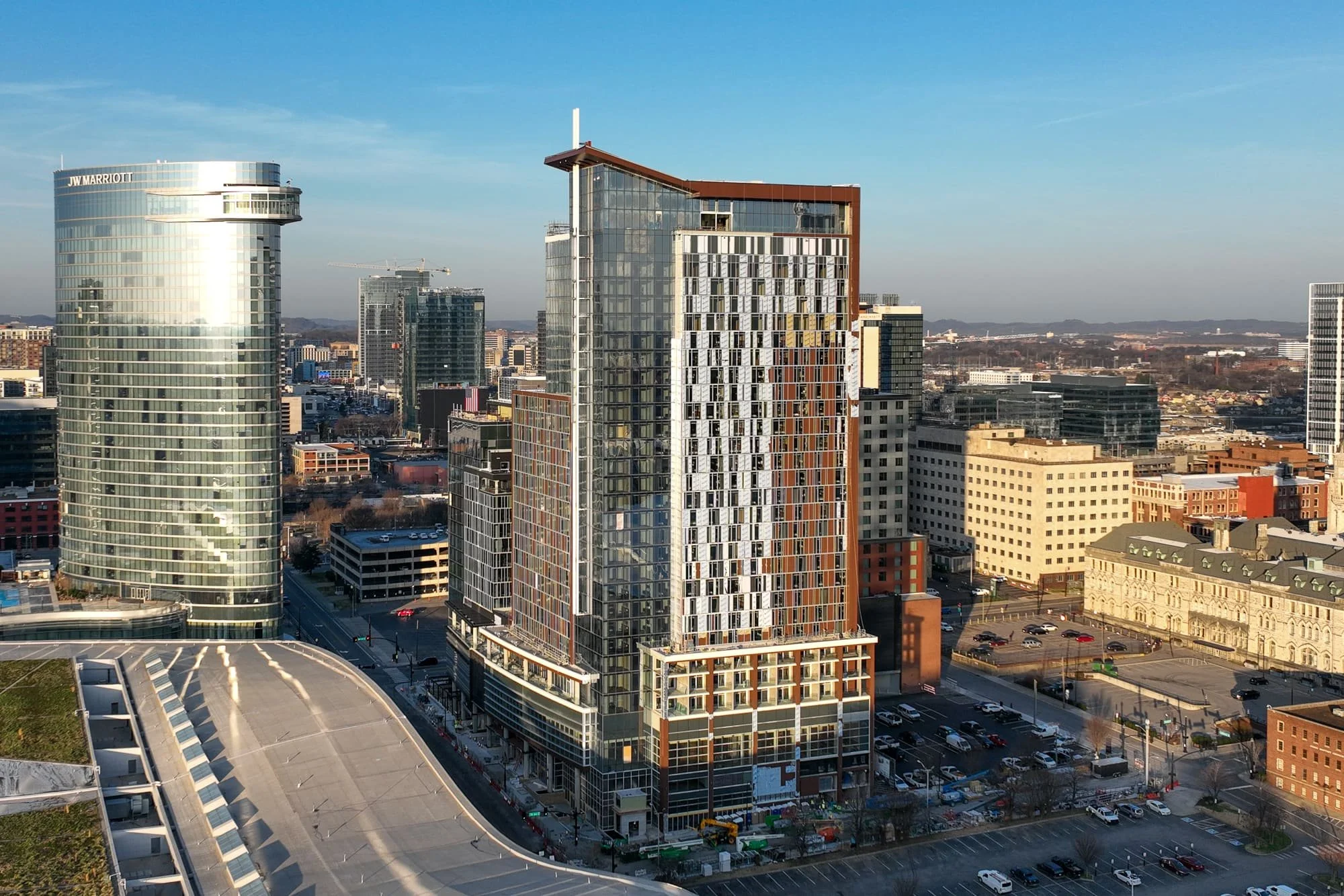
1 Hotel Nashville under construction, carefully timed to show the building's relationship to the surrounding towers.
4. Progress Documentation
This is not something I do enough of and I hope that by seeing a few of these, it will inspire you to hire your photographer (or me 😉) to also capture progress photos for you. I typically recommend coordinating key phases in the construction process with your photographer and capturing the project not just from the ground, but also the sky.
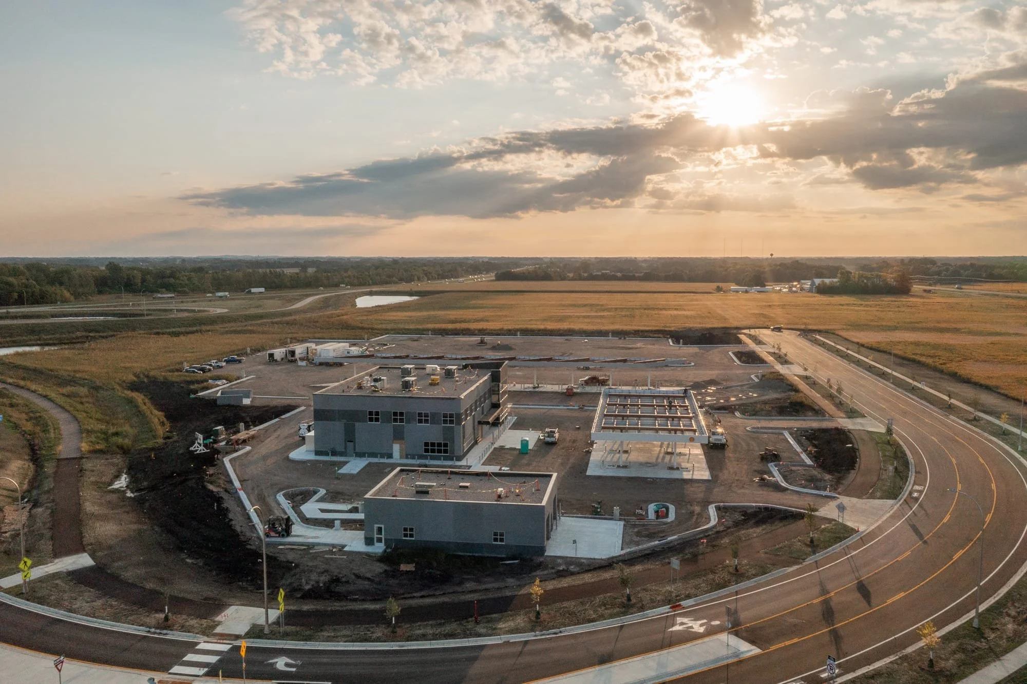
Construction progress on a truck stop project in Minnesota, captured from above at sunset.
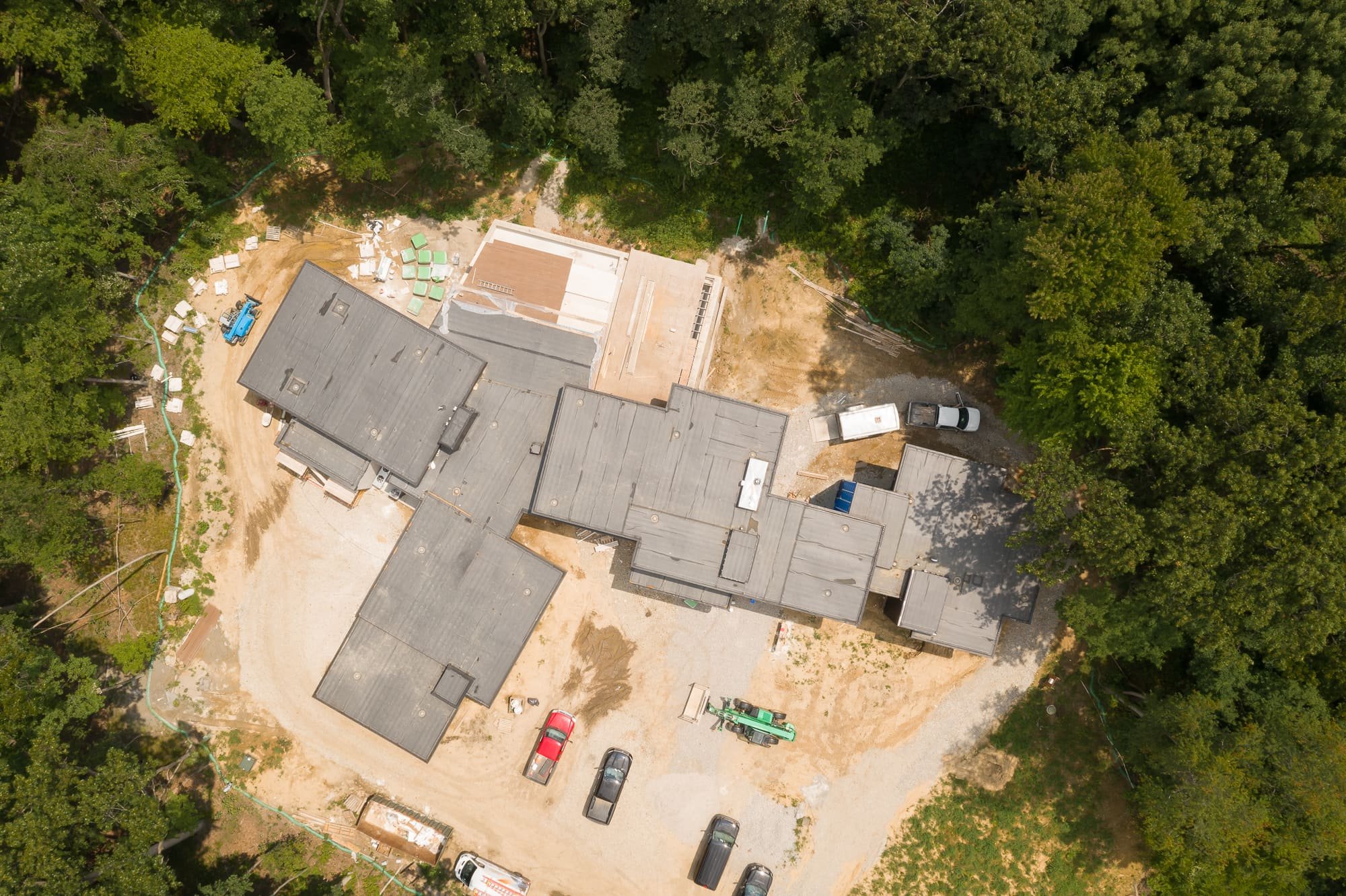
Early construction progress on a residential project in Toledo, OH, showing the site before framing began.
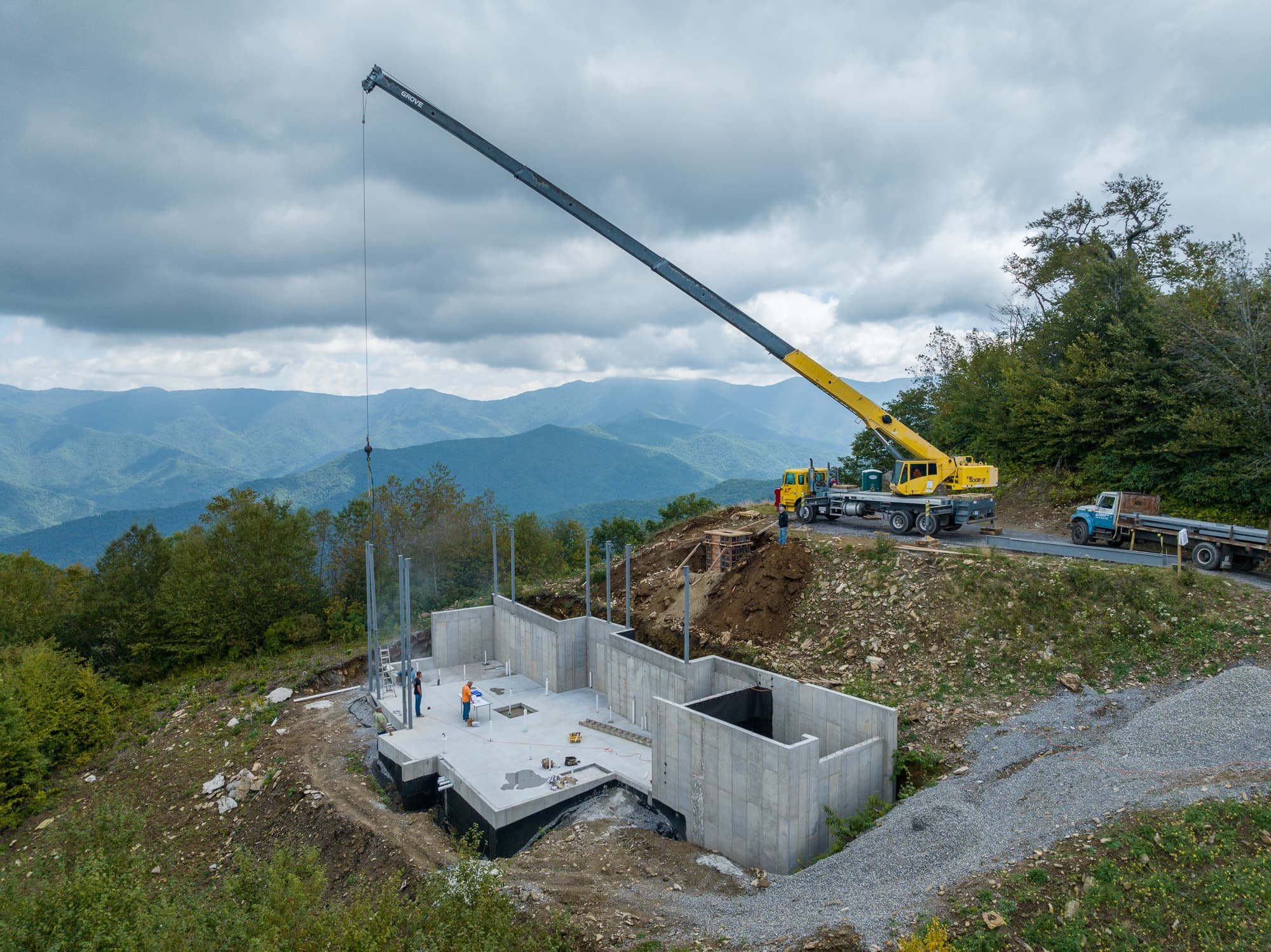
A crane installing steel into a foundation in the Western North Carolina mountains, the Blue Ridge visible beyond.
5. Drone Video Capabilities
As strange as it sounds, we hardly even notice when drone footage is being used in movies or shows anymore. It has just become so normal that it doesn't register. The same should be said for your architectural video - it must incorporate drone footage (when it makes sense to do so). Here are three use cases where drone video made a lot of sense. By the way... if you are not yet using video in your projects, you should be strongly considering it.
If you have a project that would show best from a higher perspective, let's talk about how I can help you.